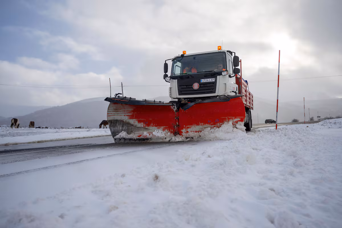
Although the hardest part of the winter episode has been experienced in these last hours, the weekend will continue to be characterized by the arrival of air of polar origin, responsible for the collapse in temperatures and the significant drop in snow levels in the areas of the Cantabrian Sea and the upper Ebro. This Friday, the State Meteorological Agency (Aemet) has activated the orange alert in Cantabria, Castilla y León, Navarra and the Basque Country due to the significant risk and accumulations that could affect highways such as those connecting the latter two territories with levels that can exceed 10 centimeters from 500 meters.
Likewise, the communities of Catalonia and the Balearic Islands are in orange, albeit due to maritime storms, according to Aemet forecasts on its website collected by EFE. Due to the snowfall, four other communities are also on yellow level alert today (risk for some activities); These are Aragon, Asturias, Catalonia and La Rioja.
Several areas of Cantabria are under orange alert for snowfall; also the Cantabrian Cordillera of Navarra and Burgos or the north of this province and the County of Treviño.
Also the center of Navarre and the Basque Country in places such as the Alava plain, the Nervión basin in Álava and the interior of Gipuzkoa. In the Cantabrian Cordillera of Burgos, the accumulation in 24 hours will be 25 centimeters starting from 900 meters, lowering the level to 700, and these quantities will be more likely the further north you go.
Snowfall will often leave 20 centimeters in 24 hours in Liébana and Cantabria del Ebro from 800-1000 meters. Higher accumulations are expected at higher levels. The warning is a continuation of the previous day.
On the Cantabrian side of Navarre and in the center of the province, thicknesses will be 10 centimeters in 24 hours starting from 500 meters and will be more likely in the northwestern part of the warning zone. The motorways connecting with the Basque Country will be affected. This notice is a continuation of that of the previous day.
Specifically, more than 10-20 centimeters could accumulate in the mountainous points of the north of the peninsula, according to Aemet data, according to which, to a less significant extent, snowfall will also affect the south of the Iberian system and the central one.
As for temperatures, highs will remain below 10 degrees across much of the peninsula – except in the south-west and on the coasts – while frosts will continue to expand, stronger in the Pyrenees, moderate in the other mountain systems of the northern half and in Betica, and weak but widespread in inland areas such as the northern plateau.
During this day the snow will not only hit the Cantabrian Mountains and Castilla y León, but will also extend to other communities such as Navarra and the Basque Country, where Aemet has activated the orange band due to heavy snowfall. In Aragon, Catalonia and La Rioja the snow warning remains at yellow level.
Entry of a warmer air mass
The situation will begin to change starting this Saturday afternoon, when the entry of a warmer Atlantic air mass will cause a rise in temperatures and snow levels.
This change will relegate snowfall and frost to mountain areas, starting a progressive stabilization of the weather. Aemet specifies that, albeit with uncertainty, the snow level in the west will rise from 500-900 meters to 1,600-2,000 meters at the end of the day, while in the rest it will rise from 400-500 meters to 700-1,000 meters with lower levels in the north-eastern areas.