On Wednesday the weather will be particularly cold for the season, according to forecasts by the State Meteorological Agency (Aemet). The entity predicts frosts in the early hours of the morning, and that maximum temperatures do not exceed 10 degrees centigrade in large areas of the Peninsula, with the exception of the south-west quadrant and the coasts, where they will be slightly higher. The agency has activated a special alert for snowfall at low altitudes for this Thursday and Friday and recommends following its updates, because it predicts that temperatures will continue to drop and intense winds will blow in the coming days.
Starting from the afternoon of this day, an air mass of Arctic origin will arrive which will cause a generalized temperature drop and snowfall on the northern third of the peninsula. On Thursday the phenomenon will progressively extend to the rest of the Peninsula and the Balearic Islands, to continue on Friday. There will be frosts within the peninsula, with the possibility of being strong in the Pyrenees and moderate in the rest of the mountainous environments of the northern half and in Betica.
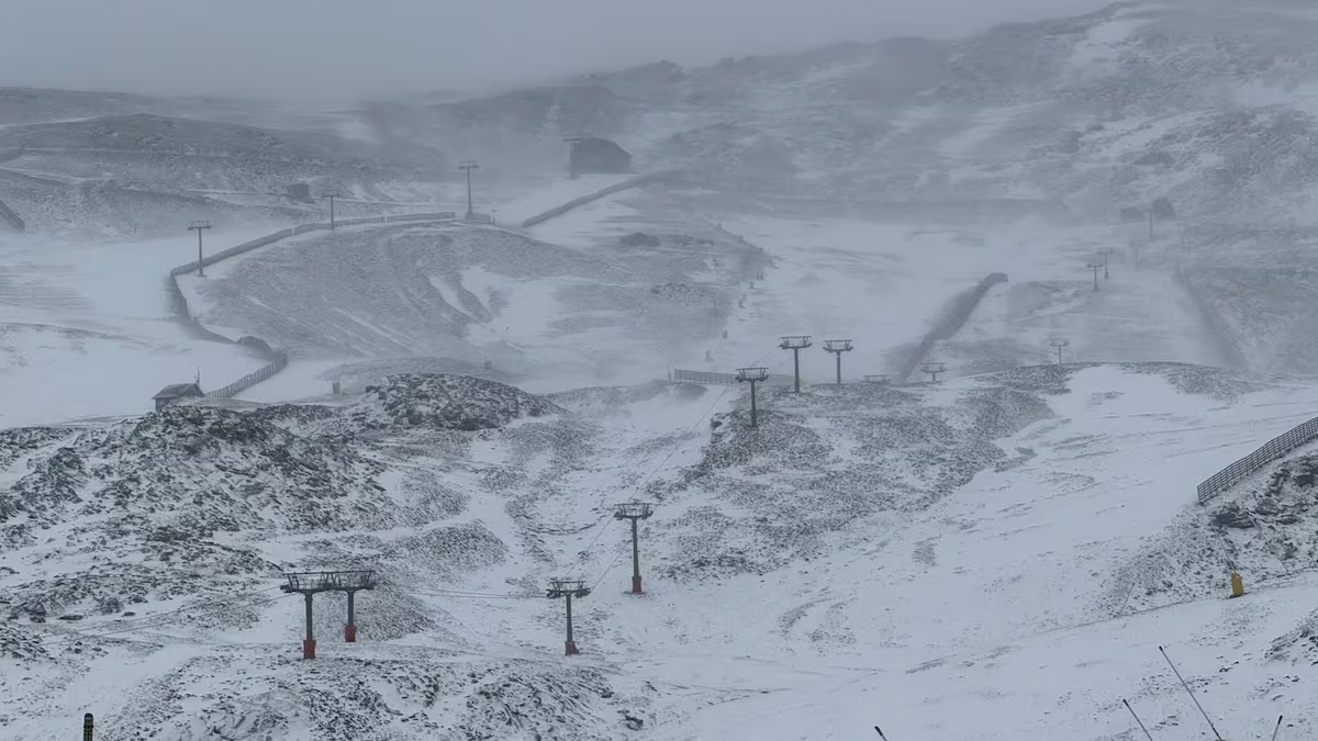
Aemet predicts a “significant drop in snow levels”, which will go from “above 1,600 meters to below 400 meters in the first part of Friday”. According to the forecast, the largest accumulations are expected in the Cantabrian Mountains, where more than 20 centimeters thick could accumulate in 24 hours. In a weaker way, they could also extend to the rest of the mountain systems of the northern half of the peninsula. It is possible that it will snow not only in the mountainous areas, but also in the surrounding low-lying areas starting from Thursday midday, such as the interior of the Basque Country, Navarra and the north of the Northern Plateau.
⚠️SPECIAL NOTICE | Snowfall at low altitudes.
➡️ Winter weather, with frost and snowfall from 300 to 400 meters in the northern third.
➡️The snow will affect cities and important communication routes. Stay informed about the situation.
+info 👉https://t.co/48Lsr8R9TN pic.twitter.com/O3el2v8ZvG
—AEMET (@AEMET_Esp) November 18, 2025
As reported by the institution, “the culmination of the episode is expected between the late hours of Thursday 20th and the morning of Friday 21st, when the snow level will be around 300 meters in the eastern Cantabrian Sea and in the upper Ebro”. The agency warns that “the impact could be significant in this area, affecting important communication routes.” Furthermore, more than 10 centimeters could accumulate again on Friday in the mountainous areas of the northern third of the peninsula. Less significant, the snowfall will also affect the Iberian and central system, without excluding it in the Catalan pre-Pyrenees.
Aemet’s statement highlights that “wind will be another significant phenomenon during this episode.” Very strong gusts are expected in the north-east of the peninsula, in the Balearic Islands and also in the mountainous areas of the eastern third, with possible snowstorms in the Pyrenees, especially on Friday and Saturday. An “intense maritime storm affecting the Balearic Sea and Empordà” is also expected.
Starting from Saturday, and “in a context of growing uncertainty”, according to forecasts, the most probable scenario is the beginning of an increase, both in temperatures and in snow levels, which would continue in the following days. Snowfall and frost will be “progressively limited to mountain areas”.