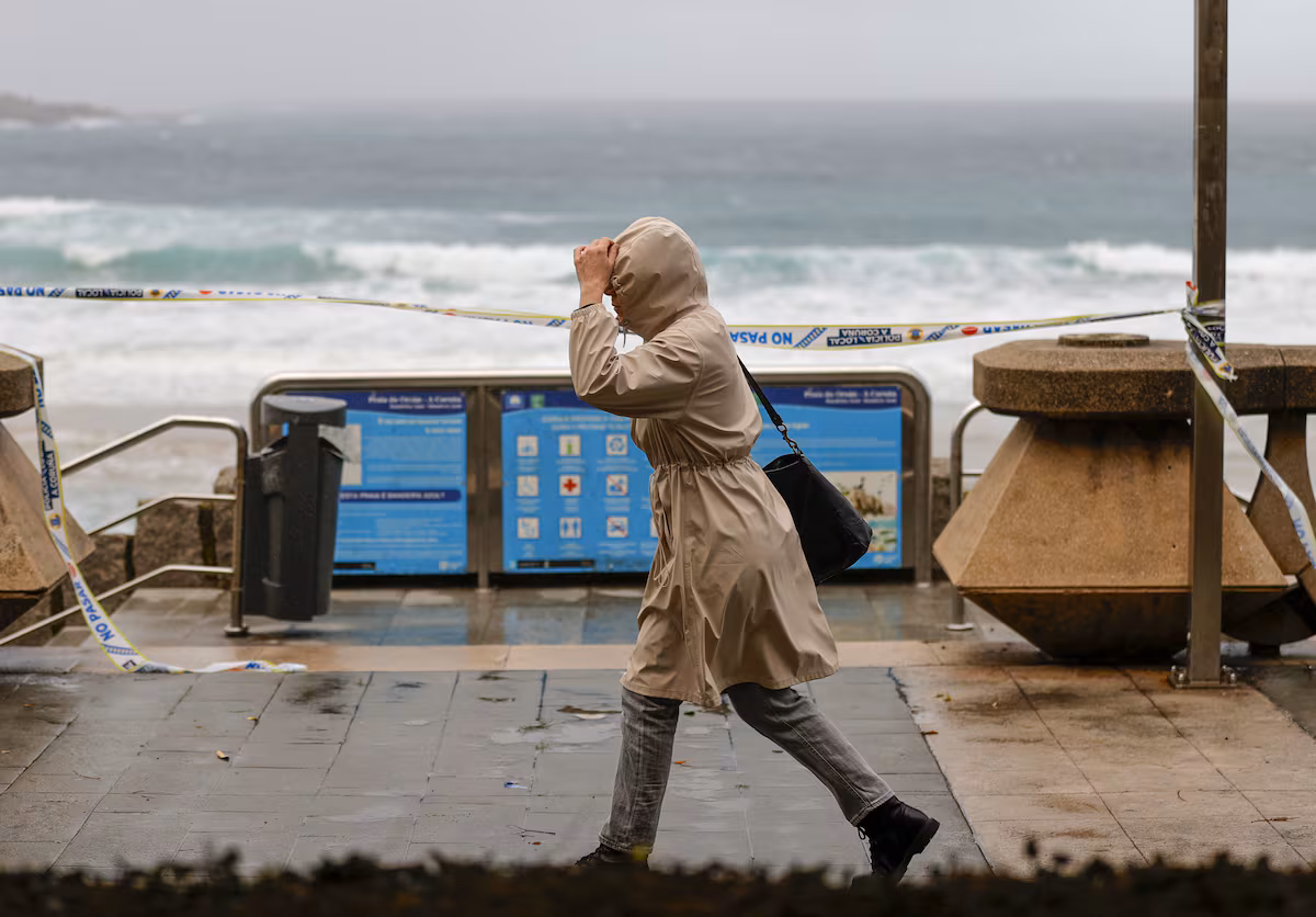
The arrival of a new front will mark the weather this Friday across much of the country, with overcast skies, widespread rain and intense wind in the north of the peninsula. Galicia will be the most affected community, where showers accompanied by thunderstorms and possible hail are expected, locally strong in the western part and with significant accumulations, according to the State Meteorological Agency (Aemet).
“We have a weekend ahead of us that will show us the two faces of autumn”, says Rubén del Campo, spokesperson for Aemet. The front will move eastward throughout Saturday, leaving rain across large parts of the country before giving way to a more stable Sunday, with cold dawns, frost in the northern hinterland and extensive fog banks.
The rains will be widespread across much of the Peninsula, although they will be less frequent and weaker in the far south-east. Significant accumulations could also be recorded in the eastern Cantabrian Sea and in the northern mountainous areas, where rainfall could be persistent. During the day, isolated thunderstorms could form inland and some instability could remain in the north-east of Catalonia. In the Canary Islands there will be cloudy intervals with the possibility of rain in the north of the islands.
Fog banks and fog will form in the mountain areas of the northern half throughout the day, especially at dawn and late in the day.
Temperatures will decrease in the north of the Southern Plateau and in the north-east of the peninsula, while they will remain without major variations in the north of Castile and León and the Balearic Islands. In the rest of the country, slight increases are expected, most notable in the mountainous areas of the north-west and inland south-east. Minimum temperatures will decrease in general, especially in the eastern third and in the Balearic Islands. Light frosts may occur in the Pyrenees.
The winds will blow from the south-west and west over the Peninsula and the Balearics, with moderate intervals and strong gusts in Galicia and the Cantabrian Sea. Very strong gusts are expected on the Galician coasts in the early morning, and also at night on parts of the Cantabrian coast. In the Gulf of Cadiz the winds will be weak from the north, turning westward and becoming moderate; In the Mediterranean area it will blow from the west with moderate intensity. Moderate trade winds will dominate in the Canary Islands, stronger in exposed areas.
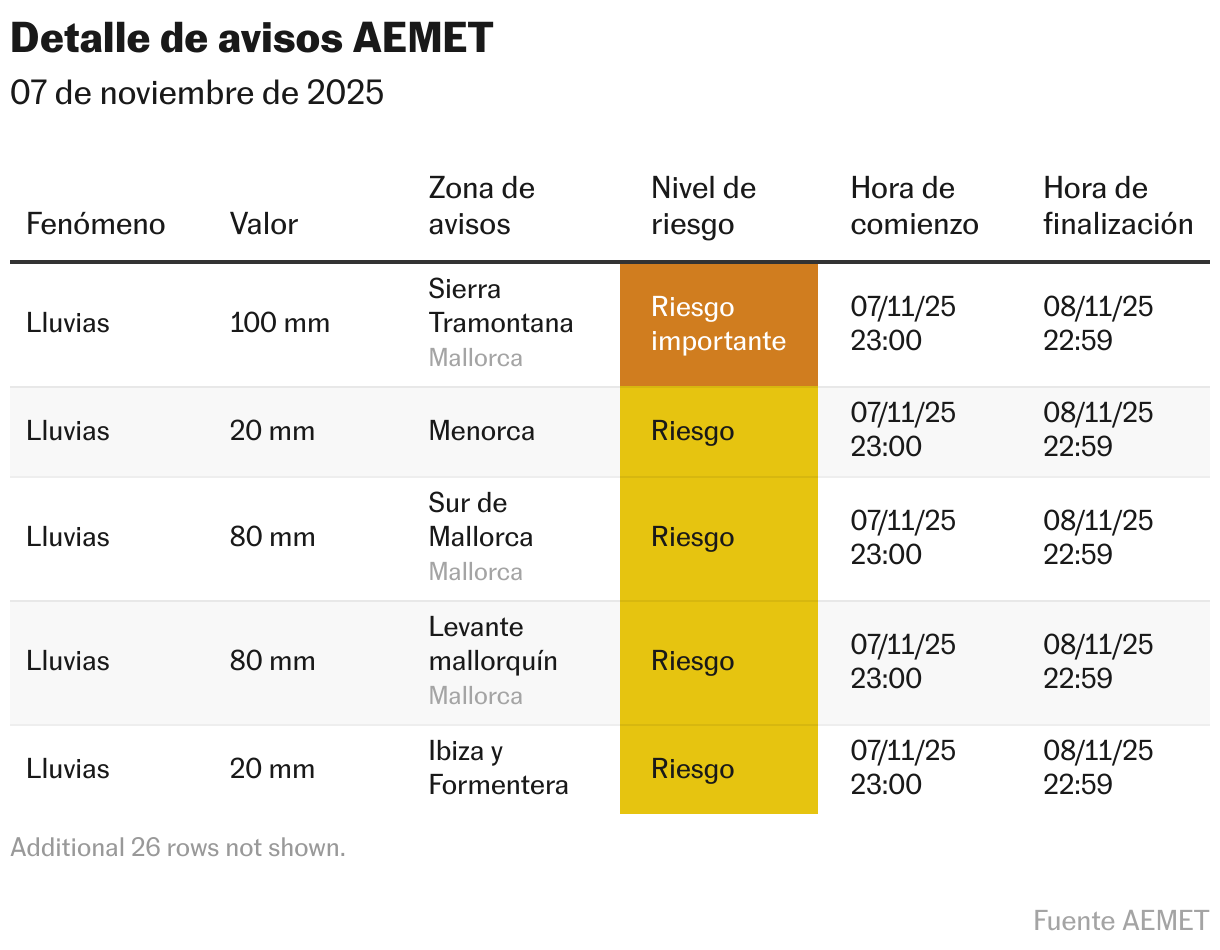
Starting from Saturday the front will move eastwards, leaving instability in the Mediterranean area and in the Balearics, where heavy showers are expected accompanied by thunderstorms and significant accumulations, especially in the north of the islands. Over the rest of the country, the skies will continue to be cloudy, but with a tendency to clear in the afternoon in large areas of the Center and South. Rainfall will be weaker in the western part and is not expected within the highlands. Snow will appear in the Pyrenees between 1,600 and 2,000 meters.
Maximum temperatures will decrease in the north and east, and increase slightly in the rest, while minimum temperatures will tend to decrease in the north-west quadrant. The wind will turn north, with gales and moderate or strong winds in the north-east and the Balearics, and very strong gusts in the mountainous areas and in the north of the Balearic archipelago. The moderate trade wind will continue in the Canary Islands, with strong gusts of wind in some hours of the day.
Sunday will show “the other side of autumn”, as Del Campo summarizes. It will be a generally stable day, although with some residual showers in the Balearics in the early hours and the possible arrival of new showers off the coast of Galicia in the afternoon. Clear skies will prevail over much of the country, but this stable environment will favor the formation of fog banks in inland areas and a sharp drop in night temperatures.