The storm Claudia It will affect the Canary Islands and the north-west of the peninsula from this Wednesday, with heavy rain, thunderstorms and very intense gusts of wind. The State Meteorological Agency (Aemet) keeps the orange alert active in Cantabria and Asturias for wind, and in Galicia for rain, wind and coastal phenomena. In the Canary archipelago the warnings will be activated from 3pm. in La Palma and at 6pm in Tenerife, due to rain, wind and thunderstorms. According to Rubén del Campo, spokesperson for Aemet, “the storm Claudia It will leave an adverse meteorological situation in the Canary Islands, with very heavy and persistent rain and also very intense winds.” The situation will continue until Thursday, when precipitation will affect a large part of the archipelago, although with less intensity in Lanzarote and Fuerteventura.
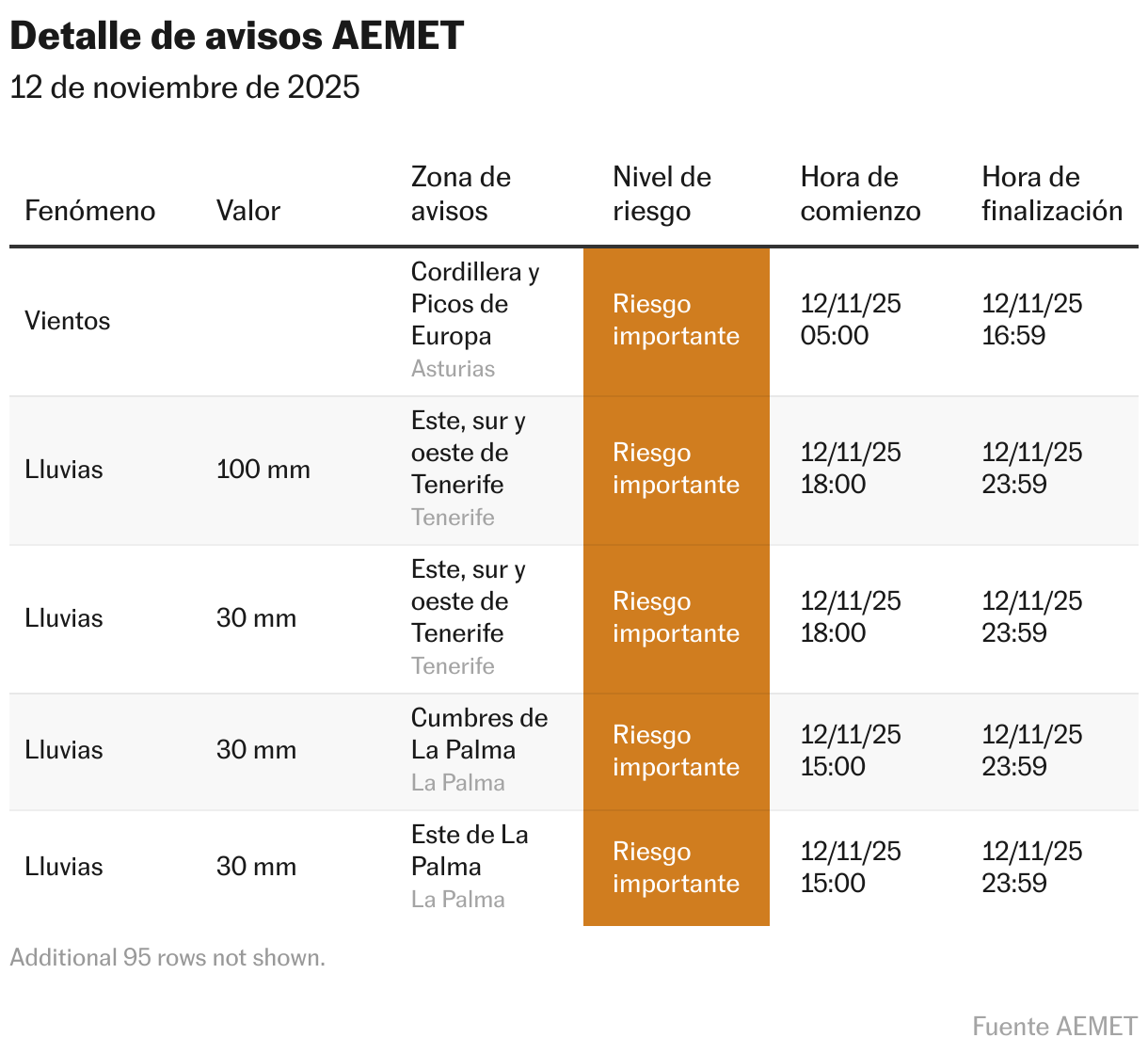
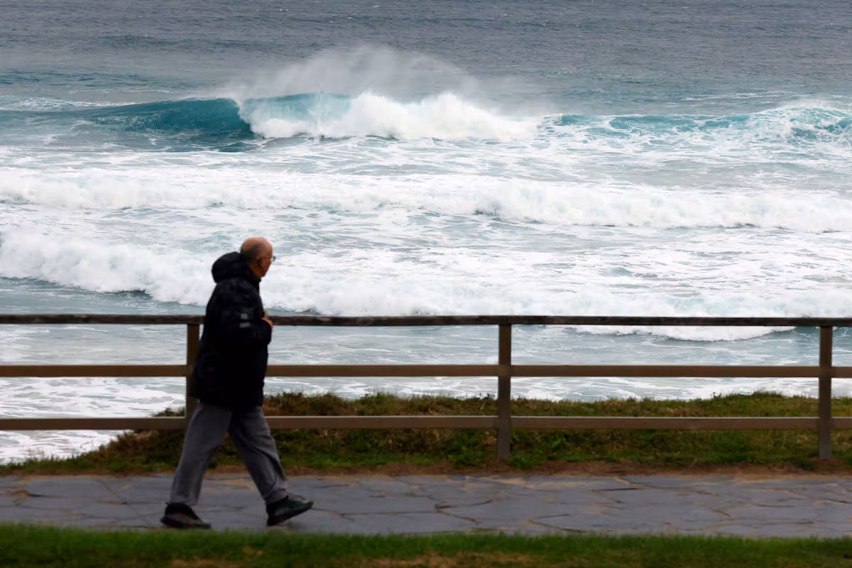
The most intense episodes are expected in La Palma, Tenerife, La Gomera and El Hierro, with the possibility of flooding of ravines and landslides. Del Campo states that it is necessary to use maximum caution when faced with the risk of rapid accumulations of water and sea storms, especially in coastal areas and ravines. The rains will arrive in Gran Canaria late on Wednesday, while on Thursday they will gradually tend to ease.
In the Peninsula, a front associated with the storm will remain stationary in the west, causing cloudy skies and heavy rain in Galicia, especially in the west and south of the community, where they may be accompanied by thunderstorms and accumulate significant quantities of water. The front will extend towards the Cantabrian Cordillera, the north of Extremadura and the south of Castilla y León, while the rest of the country will have cloudy intervals and abundant and high cloud cover. The Mediterranean area will remain out of this affair.
⚠️INFORMATION NOTE | Stormy rain and wind in the Canary Islands.
➡️ Storm Claudia will leave abundant rain and intense gusts of wind.
➡️Possible flooding of ravines, falling branches and objects in the event of high and maritime storms. Attention! https://t.co/0qneNvR4U8 pic.twitter.com/objvEFlHXf
—AEMET (@AEMET_Esp) November 11, 2025
The wind will be another of the protagonists. “Wind gusts could be very strong both in the Canary Islands and in the northern third of the peninsula, with the possibility of reaching hurricane intensity in the Cantabrian peaks,” warns the spokesperson. In the Canary Islands, winds will blow from the south-west, and in the Peninsula, from the south, which will contribute to creating an unusually temperate environment for the time.
Temperatures will remain high until mid-November. “We will reach 25 degrees in some parts of the Cantabrian Sea and up to 28 in cities like Granada,” says Del Campo. In the south-east of the peninsula, Thursday and Friday will reach between 26 and 27 degrees in Almería, Murcia and Palma de Mallorca, while in Melilla it may exceed 30 degrees.
Precipitation on Thursday will continue to be heavy in the Canary Islands and Galicia, as well as affecting the western part of the Central System, the Cantabrian Mountains and western Andalusia. Maximum temperatures will decrease in the south of the peninsula, although night temperatures will increase significantly.
On Friday the storm will begin to weaken in the Canary Islands, where there may still be showers on the most important islands. In the Peninsula, however, the rains should extend to a large part of the territory, with particular incidence in Galicia, western Andalusia, the Pyrenees, the Cantabrian Cordillera and the Central System, where they may be strong and persistent.
Over the weekend, Claudia will continue to generate unstable weather across much of the country. “The storm will remain more or less in the same position, favoring widespread showers over large areas of the Peninsula”, explains Del Campo. The heaviest rainfall is expected in western and southern Galicia, the Pyrenees, the Iberian system, Extremadura and western Andalusia.
In the Canary Islands, cloud cover will persist with showers on the mountainous islands and temperatures may begin to drop. Also according to the Aemet spokesperson “it is not excluded that the first snowflakes can also be seen in the high mountains”. The Aemet recommends caution in case of episodes of strong winds, intense rain and storm surges, as well as possible flooding of ravines and landslides.