A wave of bad weather hit Genoa and the hinterland today, November 15. Multiple interventions by firefighters due to unsafe trees, flooding, people trapped inside the sports center in Serra Riccò due to high water and then unsafe scaffolding and landslides on Via della Chiesa in San Geminiano. Another area that was heavily affected was via Vespucci where The tornado overturned a van and damaged several roofs.
There The whirlwind also caused several containers to fall in the above-ground port area of Vte harbor in Pra’. According to port authorities, there were no casualties. Damage also occurred in Sestri Ponente where the wind exposed a warehouse belonging to Amiu, the municipal company of the Municipality of Genoa that handles waste collection.
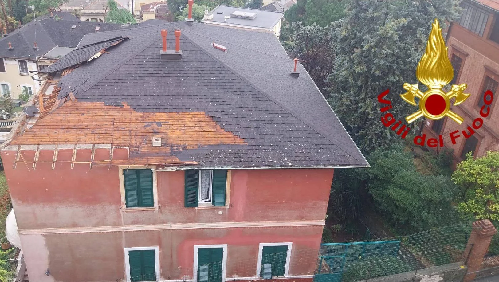
Late this morning wall collapse via Nicoloso da Recco, in Pegliat number 11. The car collapse, which also involved several cars parked across the road, disrupted gas and electricity distribution services in the area. On site, in addition to firefighters, local police, civil protection and Aster made the road safe.
Meanwhile Fegino river floodsin Valpolcevera, where the operational alarm phase was triggered. Civil protection, firefighters and local police are on the scene.
Tomorrow orange warning throughout Liguria
Tomorrow the orange warning will be in effect from 12.00 to 21.00 in most of Liguria. Last night a strong storm hit the west, with a peak of 74 mm in one hour and more than 230 mm in 12 hours between Melogno and Osiglia, while between Varazze and Arenzano the storm cell then moved west of Genoa, with 140 mm in six hours. This afternoon the phenomenon will mainly affect the Levant region, with the possibility of more intense structures on the border with Tuscany. Silence is expected overnight, more severe in the West, before a second phase of disruption occurs on Sunday morning. The latest modeling release shows high humidity in the atmosphere but little agreement on the location of the most intense phenomena: therefore, the Civil Protection has updated the warning framework.
In summary: – Zones A and D: yellow alert from tomorrow morning, orange from 12 to 6 pm, then yellow again until 9–10 pm. – Zone B: yellow until 12 pm, orange until 9 pm, then yellow until 10 pm. – Zone C: yellow until 12 pm, orange until 9 pm, then yellow until 10 pm. – Zone E: yellow until 12 noon, orange from 12 noon until 9 pm, then yellow until 10 pm. In large river basins, a yellow warning remains in effect for flooding occurring in river beds. Strong, stationary thunderstorms are expected on Sunday, capable of causing flooding, landslides and rapidly rising streams on already water-saturated ground. The phenomenon tends to end on Monday morning.
Bad weather in Tuscany
Disturbances also occurred in Tuscany, with rain and thunderstorms. The Regional Civil Protection Operations Room has issued a code yellow for strong storms and hydrogeological and hydraulic risks on small networks, effective from 6pm today, Saturday, and all day tomorrow, for the northern areas of the Region.